The mothers of invention of the Mesoamerican theory

I’m continuing to hear some old objections to the North American setting for the Book of Mormon, so apparently I need to comment on them again as I have time. I’ll frame these posts as looking at the mothers of invention of the Meosamerican theory.
______________

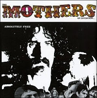
[Skip this section if you don’t want to read about the reference to the Mothers of Invention.

[When I was growing up, the Mothers of Invention was my choice of rock band for teenage rebellion. I was reminded of this recently on a Delta flight. The music list included “Brown Shoes Don’t Make It” from the “Absolutely Free” album. The Mothers’ records are so awful that my mom actually broke my vinyl album in half so I would stop listening to it. Maybe some day we’ll be able to do the same with the Mesoamerican theory that has caused so much trouble.

[The album I thought was the most clever was “We’re Only in it for the Money.” I have heard this complaint from both sides of the Book of Mormon geography issue; i.e., I’ve heard that Mesoamerican advocates promote their theory with books, tours and conferences, while “Heartlanders” do the same. In my view, neither side is in this for the money. Advocates on both sides are promoting their beliefs because they love the Book of Mormon and want to share its message with the world (and encourage LDS people to study it more). That said, there are costs involved with any educational pursuit. I have spent far, far more money on Mesoamerican books and conferences than on North American books and conferences, and certainly LDS people in general have done the same. Mormon’s Codex alone costs $59.99 at Deseret Book. Along these lines, I have to say, I hope I never again here a BYU-affiliated (i.e., tithe-payer subsidized) scholar/educator complain about other people selling books and tours. It’s bad enough that tithing money has been used in the past to support the Mesoamerican theory.]
______________

One of my favorite objections to the North American setting is the old meme that “The River Sidon flows north.”

The mother of invention of the north-flowing river was Orson Pratt’s hemispheric model, not a careful analysis of the text. Joseph Smith specifically rejected Pratt’s ideas in the Wentworth letter, but that hasn’t stopped anyone from promoting the progeny of Pratt’s ideas anyway.

Here’s my conclusion for those who don’t want to wade through the explanation:

The notion that there is a north-flowing river from the land of Nephi to the land of Zarahemla is correct, but it’s not the Sidon River. Translated into the modern world, the Sidon is the Mississippi, and the river flowing from the land of Zarahemla up in elevation and south to the land of Nephi is the Tennessee River.
______________

Here’s how the idea of a Mesoamerican north-flowing river Sidon started. In the 1920s, some RLDS and LDS scholars convinced themselves that the Book of Mormon took place in a limited area of Central America. This meant the “real” Cumorah could not be in New York, which led to the bizarre “two Cumorahs” theory.

This theory also presented the problem that the only two significant rivers in the area of Mesoamerica flow north. Therefore, these scholars concluded, the river Sidon must flow north. To justify their theory, they imposed an interpretation on the text that has become their default standard. It’s an example of the “ruling theory” that I mentioned in my last post.

If you went to the link I provided in that post, you saw this explanation of the result of the “ruling theory” approach:

“Our premature explanation can become a tentative theory and then a ruling theory, and our research becomes focused on proving that ruling theory. The result is a blindness to evidence that disproves the ruling theory or supports an alternate explanation. Only if the original tentative hypothesis was by chance correct does our research lead to any meaningful contribution to knowledge.”

You find this happening throughout the writings of the LDS scholars and educators who promote the Mesoamerican setting.
______________________

The latest example is Book of Mormon Central (BOMC) (https://bookofmormoncentral.org/), which is merely a front for Mesoamerican advocacy groups. It started as a front for “ancientamericafoundation.org,” a long-time promoter of the Mesoamerican dogma, but BMAF is now a front for Book of Mormon Archaeological Forum, Inc. (http://bmaf.org/), which is essentially a club for Mesoamerican advocates. (“The legal organization behind Book of Mormon Central is the Book of Mormon Archaeological Forum, Inc., a 501 (c) 3 non-profit public charity chartered in the state of Utah in 1983.”) See my post about BMAF from last year:
http://bookofmormonwars.blogspot.com/2016/02/bmaf-conference.html.

You can have all kinds of fun going through the BOMC archives learning about Sidon flowing north. (Mostly, you’ll read about the comical debates about whether the Usumacinta or the Grijalva is the “real Sidon.”) That’s why I call BOMC Book of Mormon Central America. (I stopped calling it that for a while because they promised me they’d be neutral, but instead, they’ve doubled down on the Mesoamerican stuff, so there’s no reason not to refer to them as Book of Mormon Central America. In fact, referring to them as Book of Mormon Central, as if they were neutral, would be more misleading.)
______________________

Another of my favorites is BYU Studies. This mostly excellent journal is, sadly, deeply infected with Mesomania. Right on the main page, they have a link to “Book of Mormon Charts,” here: https://byustudies.byu.edu/book-of-mormon-charts. This includes a list of “Ten Essential Features of Book of Mormon Geography.” You have to see this to believe it.

Go to this link: https://byustudies.byu.edu/charts/13-149-ten-essential-features-book-mormon-geography. Most of these “essential features” are illusory and based on circular reasoning and confirmation bias (i.e., designed to “prove” the false Mesoamerican theory), but look at number 5.

“5. The river Sidon flowed northward through Zarahemla.”

The maps and explanations included in the “Book of Mormon Charts” depend on this assumption. Actually, all the Mesoamerican theories depend on this assumption.

But it’s an assumption that doesn’t make sense when we read the text carefully.
______________________

Here’s an excerpt from my book Moroni’s America that addresses this specific issue.

Flowing North or South?
A common objection to the North American setting relies on the theory that the River Sidon flows north like the major rivers in Central America<!–[if supportFields]> XE "Central America" <![endif]–><!–[if supportFields]><![endif]–>. Because the Mississippi flows south, goes the argument, North America cannot be the setting.[i]

To address this issue, I refer to an analysis by one of the most thoughtful and careful advocates of the Mesoamerican theory.[ii]He summarizes the history of the issue and identifies his proposed location in Mesoamerica<!–[if supportFields]>XE "Mesoamerica" <![endif]–><!–[if supportFields]><![endif]–>.
“The northerly flow of the Sidon has been well-understood by Book of Mormon students for over a century. In his notes to the 1879 edition of the Book of Mormon, Orson Pratt<!–[if supportFields]> XE "Pratt, Orson" <![endif]–><!–[if supportFields]><![endif]–> said the river flowed northward, [Note: this isn’t true. Pratt’s footnote to Alma 2:15 reads “supposed to be Magdalena.” but he says nothing about it flowing northward. The Magdalena river does flow northward (it is in Colombia), but Pratt did not choose it because of the direction of its flow. Pratt assumed South America was the “land southward” so he “supposed” the Magdalena was Sidon because he thought it was near the narrow neck of land.] an observation that persisted in the indices to the 1920 edition prepared under the direction of James E. Talmage and the 1980 edition prepared under the direction of Bruce R. McConkie. In his magnum opus published in 1899 (A Complete Concordance of the Book of Mormon), George Reynolds correlated the Sidon with the north-flowing Magdalena in modern Colombia. In his 1917 work Geography of Mexico and Central America<!–[if supportFields]> XE "Central America" <![endif]–><!–[if supportFields]><![endif]–> from 2234 BC to 421 AD Louis Edward Hills correlated the Sidon with the north-flowing Usumacinta. The New World Archaeological Foundation’s first season of field work in 1953 was near Huimanguillo, Tabasco west of the north-flowing Grijalva. Daniel H. Ludlow’s internal reconstruction of Book of Mormon geography, distributed throughout the Church Educational System for decades, shows the Sidon flowing north to the sea. John E. Clark’s article “Book of Mormon Geography” in the 1992 semi-official Encyclopedia of Mormonism includes the north-flowing Sidon as one of the few tenets of Book of Mormon geography unambiguously attested in the text. We established previously that the Usumacinta River is the viable candidate for The Book of Mormon’s river Sidon… As we would expect, the Usumacinta flows generally from south to north.”
_________________________
Despite that impressive history, the author, who is a Mesoamerican advocate, doesn’t seem to realize that the “north-flowing” Sidon dogma originated with the hemispheric model, which Mesoamerican advocates reject. It was Orson Pratt’s hemispheric idea, which Joseph Smith specifically rejected in the Wentworth letter, that led Pratt to name the Magdalena River because it was the only major river located near Pratt’s idea of the narrow neck of land. 
Fortunately, the most recent editions of the Book of Mormon deleted the description of Sidon as a north-flowing river. The text simply does not say that the river flows north.
The argument for a north-flowing Sidon is well presented in the following seven answers to the initial question.[iii] I offer my own analysis (designated JN1, JN2, etc.) after the answers provided by the original author (A1, A2, etc.)
_________________________
Q. How do we know the river Sidon flowed south to north?
A1. Near the land of Zarahemla<!–[if supportFields]> XE "Zarahemla" <![endif]–><!–[if supportFields]><![endif]–>, the hill Amnihu Alma 2:15, 17 and the valley of Gideon Alma 6:7 were both east of the river Sidon. Near the city of Zarahemla, the river Sidon had a west bank Alma 2:34. These data points all imply a general north/south orientation for the river in that part of its course.
JN1: I agree.
A2. Beyond (south of) the land of Manti, a south wilderness Alma 16:6, 7 lay east of the river Sidon. This implies a general north/south orientation for the river in that part of its course.
JN2: I agree, except for the parenthetical (south of). The text doesn’t say south of Manti, it says beyond Manti. Beyond the land of Manti can be on the east side of the river, with the wilderness still designated as south in relation to Zarahemla<!–[if supportFields]> XE "Zarahemla" <![endif]–><!–[if supportFields]><![endif]–> and other sites to the north.
A3. Upstream from (south of) the land of Manti Alma 43:32, Captain Moroni<!–[if supportFields]>XE "Moroni" <![endif]–><!–[if supportFields]><![endif]–> placed part of the Nephite army west of the river Sidon Alma 43:27 and another part east of the river Sidon Alma 43:53. These data points imply a general north/south orientation for the river in that part of its course.
JN3: The first part of this answer—upstream from—simply assumes the conclusion. The text never says which way the river is flowing. Moroni<!–[if supportFields]> XE "Moroni" <![endif]–><!–[if supportFields]><![endif]–> concealed part of his army in the valley that was on the west of the river Sidon and part into the valley on the east “and so down into the borders of the land Manti.” The text doesn’t say whether Moroni started out north or south of Manti, but Manti was on or near the border<!–[if supportFields]> XE "border" <![endif]–><!–[if supportFields]><![endif]–>. It wouldn’t make sense to have Moroni crossing the border into Lamanite territory and fortifying northward; instead, he would be fortifying the Nephite side of the border, from the north toward the south. That he went “down into the borders” shows the river flowed from the north to the south.
A4. One verse in the text has been interpreted to mean that the river Sidon flowed from east to west in part of its course. Alma 22:27 is ambiguous. It could mean that the river Sidon flowed from east to west at that point. Given the repetitive nature of Mormon’s phrasing, though, it is more likely that all the east to west references in Alma 22:27-29 refer to the narrow strip of wilderness<!–[if supportFields]>XE "narrow strip of wilderness" <![endif]–><!–[if supportFields]><![endif]–> that separated Nephite lands on the north from Lamanite lands on the south. The text mentions several geographic entities or human activities either east or west of the river Sidon. The text never mentions entities or activities directly north or south of the Sidon. All of these data points reinforce the notion that the Sidon flowed in a general north/south direction over most of its length.
JN4: I agree with this, and add that my chiastic analysis explains it in more detail. Nothing here speaks to the direction of flow, however.
A5. The land of Manti was south of the land of Zarahemla<!–[if supportFields]>XE "Zarahemla" <![endif]–><!–[if supportFields]><![endif]–> Alma 17:1. The land of Manti was also near the head of the river Sidon Alma 43:22. From the head of the river Sidon, one went down in elevation to Zarahemla Alma 56:25. These data points indicate that the river Sidon flowed generally northward from Manti to Zarahemla.
JN5: I agree with the first two sentences, but the third one is not what the text says, and the fourth is a faulty inference. Alma 56:25 says the Lamanites had a choice to “march down against the city of Zarahemla<!–[if supportFields]>XE "Zarahemla" <![endif]–><!–[if supportFields]><![endif]–>” or they could “cross the head of Sidon.” It doesn’t say they were atthe head of Sidon. Instead, in 56:29, it says the Lamanites, who had decided neither to march against Zarahemla nor to cross the head of Sidon, “began to sally forth,” a concept that is repeated in 3 Nephi 4:1 when the Gadianton robbers began to “sally forth” out of the mountains<!–[if supportFields]> XE "mountains" <![endif]–><!–[if supportFields]><![endif]–> and hills<!–[if supportFields]> XE "hills" <![endif]–><!–[if supportFields]><![endif]–>. The text indicates that the Lamanites in Alma 56 were in a highland area, from which they could either march against Zarahemla or cross the head of Sidon. The area around the head of Sidon in Missouri and Illinois has many high areas that the river flows through—from the north to the south—even though the elevations are higher in the south than in the north. It’s the elevation of the riverbed that determines flow, not the elevation of the surrounding areas, as I’ll show below.
A6. The greater land of Nephi was south of the greater land of Zarahemla<!–[if supportFields]>XE "Zarahemla" <![endif]–><!–[if supportFields]><![endif]–> Alma 50:7. An east/west dividing line separating the two lands ran by the head of the river Sidon Alma 50:11. To go from Zarahemla to Nephi, one went up in elevation Alma 2:24. Therefore, the river Sidon which bordered the land of Zarahemla Alma 2:15 flowed generally from south to north.
JN6: The error here is easy to see. The argument would make sense if all terrain followed the river, meaning it drops in elevation along with the flow of the river. However, that is true only of the riverbed itself, not the surrounding area. In Egypt, the Nile flows north through some wide valleys at low elevation before cutting through higher elevation mountains<!–[if supportFields]> XE "mountains" <![endif]–><!–[if supportFields]><![endif]–> to the north. Similarly, the Rhine River flows through a low elevation through central Germany before carving its way through the mountains between Bingen and Koblenz. In the U.S., the Mississippi River flows south, but on its way south it passes by higher elevations in Missouri on the west and in Tennessee and Alabama on the east. The banks of the Mississippi south of St. Louis rise over 650 feet above sea level. Montrose, Iowa—260 miles north of Arcadia—is at 531 feet. So even though the river is flowing south, it is flowing through terrain that is higher in elevation.
The other major error here is that the text never says the River Sidon leads up to the land of Nephi. While I agree people had to travel upstream—and south—to get to the land of Nephi, it wasn’t along the River Sidon that they did so. The text says only that the River Sidon flowed next to Zarahemla<!–[if supportFields]> XE "Zarahemla" <![endif]–><!–[if supportFields]><![endif]–>, not next to the city of Nephi. So how did people travel upstream to get to Nephi? They would travel from the head of Sidon up the Ohio River to the Tennessee River, and then up that river to Nephi. The Tennessee River flows north from the land of Nephi.
A7. The Mulekites made landfall in the land northward Alma 22:30, then founded their capital, Zarahemla<!–[if supportFields]> XE "Zarahemla" <![endif]–><!–[if supportFields]><![endif]–>, in the land southward Mormon 1:6 along the Sidon Mormon 1:10. As the Mulekites traveled south from the seacoast they went up in elevation Alma 22:31. This means the Sidon flowed downhill toward the north.
JN7: This is a common misunderstanding, based on an erroneous conflation of two different accounts that referred to two entirely different events. I explain this in more detail in the chapter on Omni, but for now I note that the account in Alma 22:30-31 was not referring to the people of Zarahemla<!–[if supportFields]>XE "Zarahemla" <![endif]–><!–[if supportFields]><![endif]–> who came from Jerusalem, but to the 43 scouts—people of Zarahemla—sent by King Limhi to find Zarahemla (Mosiah 8 and 22). This becomes evident when the text is carefully examined.
Mormon correctly described the land of Zarahemla<!–[if supportFields]> XE "Zarahemla" <![endif]–><!–[if supportFields]><![endif]–> as southward from where he was at the time. Throughout the text, the phrase “the land southward” is not a proper noun but a relative designation. Mormon’s use of the term in Mormon 1:6 does not equate to the land southward as defined in Alma 22.
Zarahemla<!–[if supportFields]> XE "Zarahemla" <![endif]–><!–[if supportFields]><![endif]–> waslocated along the river Sidon. However, the conclusion that the river flowed south does not follow. Even if someone traveled south and went up in elevation, a river in that area could still flow north or south. It is the elevation in the river bed that matters, not the elevation of surrounding terrain, as I’ve shown in the examples from Egypt, Germany, and North America.
Conclusion.
The text describes the River Sidon as having a north/south orientation, but it does not specify the direction of flow. One must infer direction of flow from other information about proximate locations, but these show the river flowing south, not north—just like the Mississippi River. Passages in the text that refer to going “up” to the land of Nephi and “down” to the land of Zarahemla<!–[if supportFields]>XE "Zarahemla" <![endif]–><!–[if supportFields]><![endif]–> are explained by the Tennessee River, which did flow downhill—and northward—through the Land of Nephi to the land of Zarahemla.
So the notion that there is a north-flowing river is correct, but it’s not the Sidon River. Translated into the modern world, the Sidon is the Mississippi, and the river flowing up and south to the land of Nephi is the Tennessee River.


[i] There are some small rivers in North America that flow north, which is the basis for some proposed geographies in limited areas such as western New York, but these models have other problems. Besides, a north-flowing river contradicts the text.
[ii] The discussion of the River Sidon in this section is a response to a blog entry titled “River Sidon South to North,” dated November 8, 2011, by Kirk Magleby. It is located online here: http://bit.ly/Moroni125. Brother Magleby is one of the founders of FARMS and is an outstanding scholar of the Book of Mormon. His posts on his blog are thoughtful and detailed. I think his focus on Mesoamerica<!–[if supportFields]> XE "Mesoamerica" <![endif]–><!–[if supportFields]><![endif]–> has affected his interpretations of the text, but his analysis of the various issues is superb.
[iii] Ibid. The original answers are designated by A1, A2, etc.

Source: Book of Mormon Wars